Environmental Values
The quality of natural waters in Queensland is managed under the Environmental Protection Policy (Water) 2009 (EPP(Water)). The EPP(Water) achieves the objective of the Environmental Protection Act 1994 (EP Act) to protect Queensland’s waters while supporting ecologically sustainable development. Queensland waters include water in rivers, streams, wetlands, lakes, aquifers, estuaries and coastal areas.
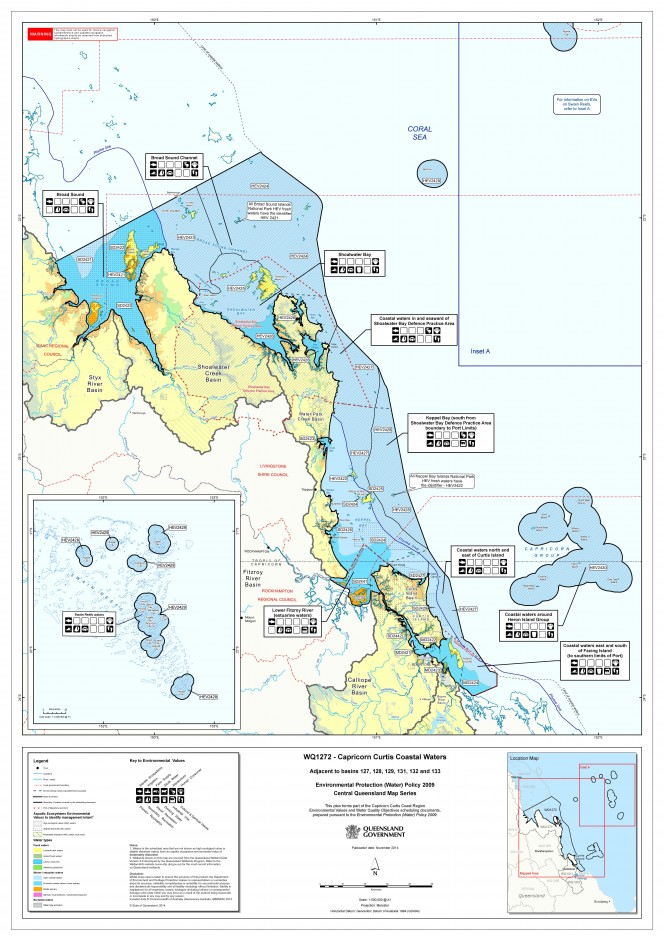
Environmental values (EVs) and water quality objectives (WQOs) are being progressively determined for areas of Queensland (refer to maps of our regions below). EVs define the uses of the water by aquatic ecosystems and for human uses (e.g. drinking water, stock water, irrigation, aquaculture, recreation, industry). WQOs define objectives for the physico-chemical characteristics of the water (e.g. nitrogen content, dissolved oxygen, turbidity). Where sufficient information exists, biological indicators can also be used (e.g. fish, macroinvertebrates). Once they are finalised and approved by Government, EVs/WQOs are included in Schedule 1 of the EPP (Water). EVs/WQOs for Fitzroy Basin waters were scheduled in 2011 (update planned). EVs/WQOs for the Capricorn and Curtis Coasts were scheduled in 2014. FBA was heavily involved in development of these EVs/WQOs, including coordination of regional stakeholder meetings and consultation. Final EVs/WQOs are available from the EHP website.
Local EVs and WQOs inform planning and decision making for development under the Environmental Protection Act (e.g. point source environmentally relevant activities); local government planning and decision making for urban land development under the State Planning Policy—state interest guideline: Water quality; best practice management approaches to address diffuse emissions from rural lands; development of report cards on aquatic ecosystem health; and catchment scale management planning and decisions by regional natural resource management (NRM) bodies.
As a World Heritage Area and Marine Park, the desired state of the Great Barrier Reef Region is that all ecosystems be of high ecological value. While there are no aquatic ecosystems in Australia that are entirely without some human influence, the ecological integrity of high conservation/ecological-value systems is regarded as being intact. For Great Barrier Reef waters, the area affected by flood plumes with a high risk of impact on critical aquatic ecosystems such as coral reefs and seagrass meadows is acknowledged as being in a slightly to moderately disturbed state (shown on map at right as the plume line). These waters are identified, with some adaptation, through modelled outputs of the risk assessment element of the Reef Scientific Consensus Statement 2013.
For waters of the Great Barrier Reef that are outside state coastal waters, the objectives from adjacent waters of the same type apply. Water seaward of the plume line has typically been identified for the highest level of protection (high ecological value). This management intent extends seaward to the limits of the marine park.
For more detail visit the EHP web site.
Click on the map at right to view the Environmental Values for the Capricorn and Curtis Coastal Waters.


